New contracts for Copernicus Land Monitoring Services
We are delighted to announce that GeoVille was contracted by the European Environment Agency (EEA) to implement the update of the Copernicus High Resolution Layers (HRLs) Imperviousness and Water & Wetness.
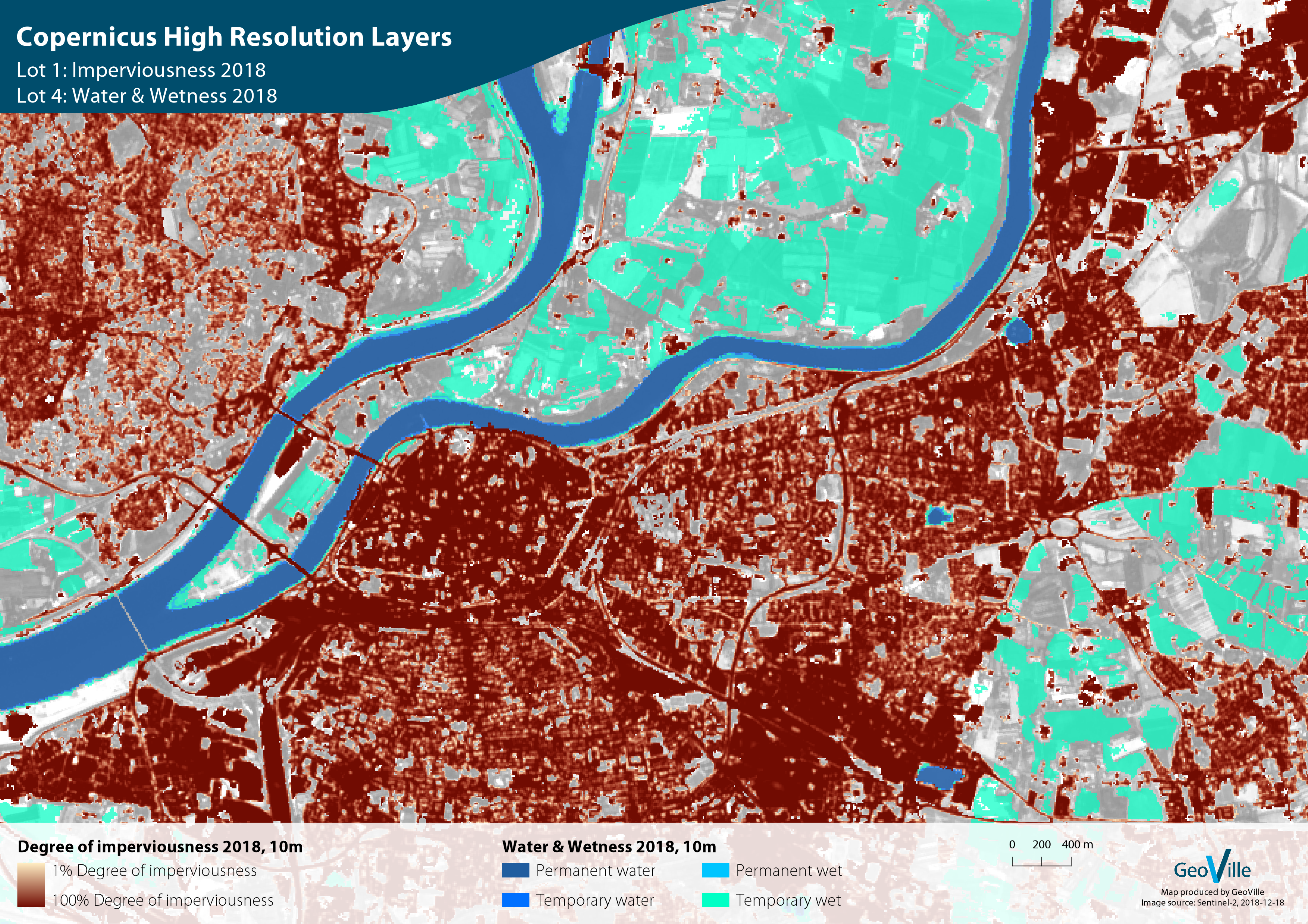
The Copernicus High Resolution Layers (HRLs) provide consistent pan-European land cover characteristics derived from high to very-high resolution satellite imagery, including ESA’s Sentinel-1 and Sentinel-2 satellites. The objective is to provide satellite-based information on Europe’s environmental status and its changes. The data obtained will be used for applications in the areas of infrastructure development, water management, as well as the monitoring of Climate Change and Sustainable Development Goals.
In combination with our analytical frameworks and advanced algorithms for time series data mining, Sentinel data streams will become a game-changer for ongoing and future Copernicus Land Monitoring Services and new high-resolution applications at global scale.
The update of the HRL’s in the frame of the continental component of the Copernicus Land Monitoring Service (CLMS) will be performed with our partners SIRS in Lot 1 and VITO in Lot 4. Further, we will support the update of the Grassland lot 3 led by GAF.
Copernicus High Resolution Layers