Boosting economic
growth with
satellite solutions

Solutions for the corporate sector

Industries worldwide are confronted with new challenges to maintain competitiveness, such as globalisation, digitisation, access to human capital and commodities, and environmental obligations.

GeoVille provides targeted intelligence solutions to the corporate sector to tackle these challenges efficiently. Satellite Earth observation data and geospatial information offer unprecedented insights to analyse the performance or activities of growth industries, for banks stocktaking the status of a sector, for goods producers trying to find new markets and suitable manufacturing locations, and for insurers assessing the evidence of claims.

GeoVille supports industries in fully exploiting the capacity of satellite applications by integrating them in their current workflows. Thereby, we provide solutions to open up new opportunities, facilitate growth or simply explore new business models. This enables our customers to unlock new insights, deliver competitive advantages and reduce costs.


Our clients:

  • Financial sector
  • Trading & retail
  • Food industry
  • Construction
  • Energy
  • Telecom
  • Transport
  • Insurance
  • Consulting

We deliver ...

  • stocktaking and monitoring to provide quantitative indicators of economic activities
  • continuous monitoring of multi-site infrastructures or value chain activities to provide homogenous information flows for change alert and pro-active response
  • assessment studies to detect geographic site suitability for developments
  • quantitative studies to reveal potential demand for goods and services
  • spatial baseline information for planning of geo-marketing campaigns
  • digital cartography and promotion material

Information Products

Prev Next

Germany | Berlin

Satellite imagery for promotion campaign
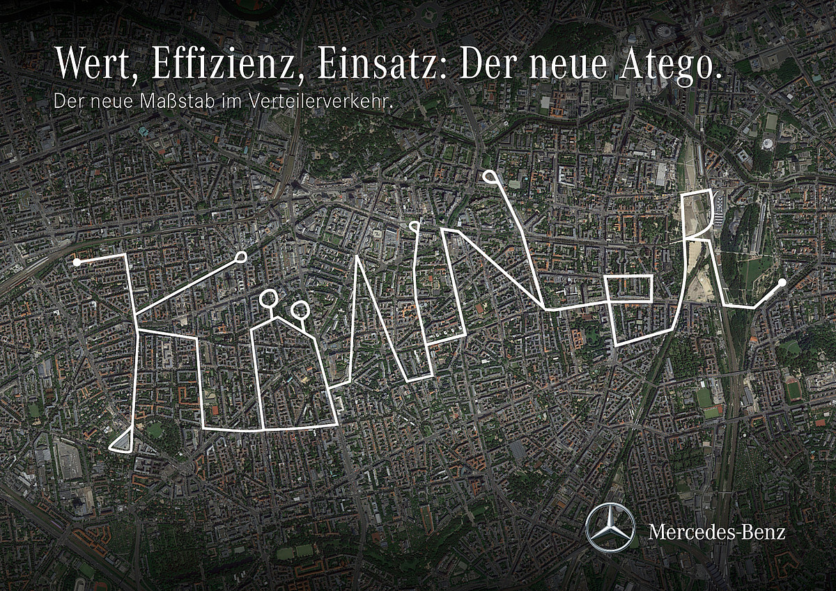
Germany | Berlin

Very high-resolution satellite imagery of major European cities for Mercedes Benz marketing campaign Atego.

Saudi Arabia | Ghawar

Time-lape maps of oil related infrastructure
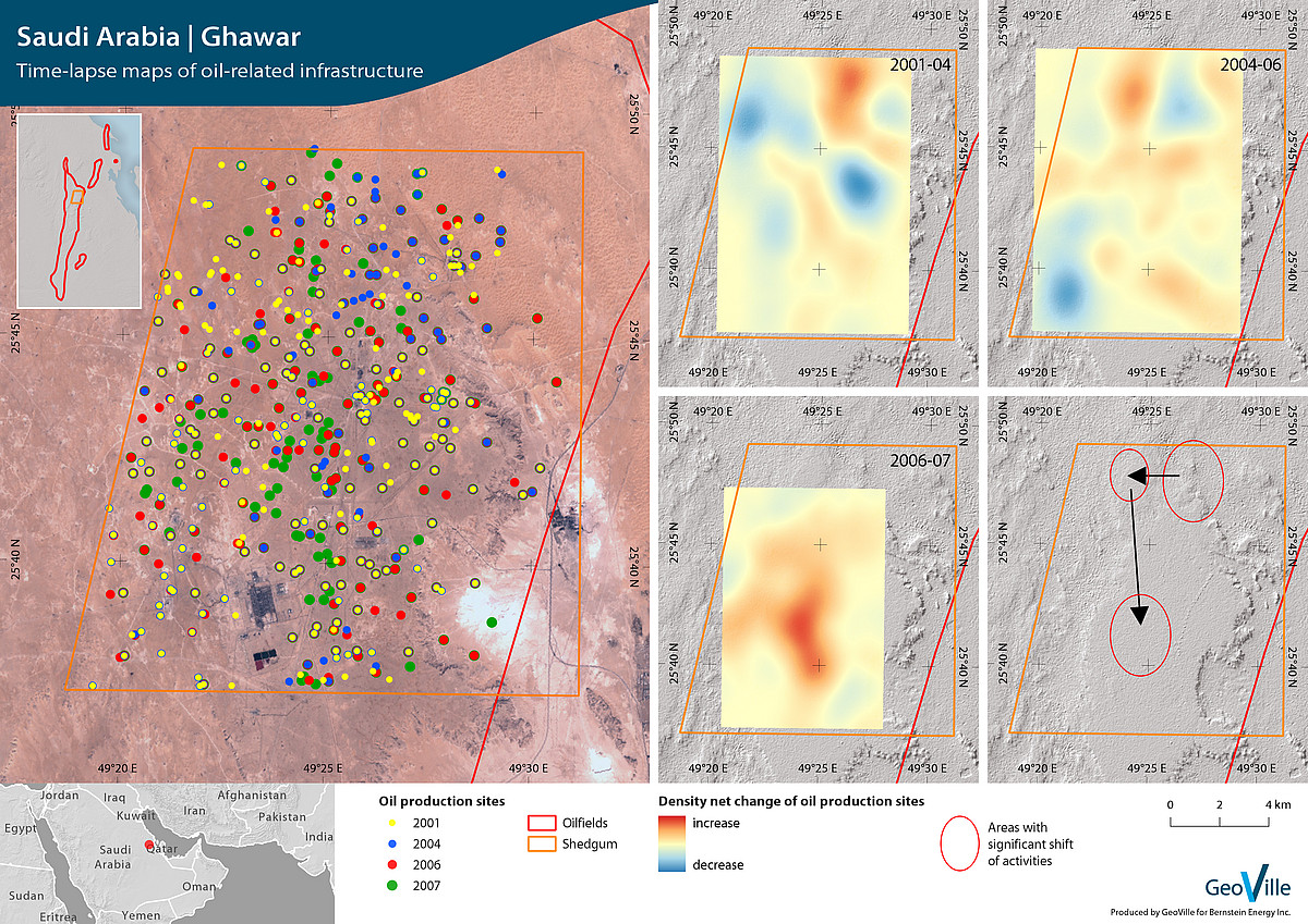
Saudi Arabia | Ghawar

Earth observation based time-lapse and density net change maps of oil production sites and related infrastructure in the Ghawar oil field. Such information were used to draw conclusions on the oilfield production activities.

Mexico | Mexico City

Street network
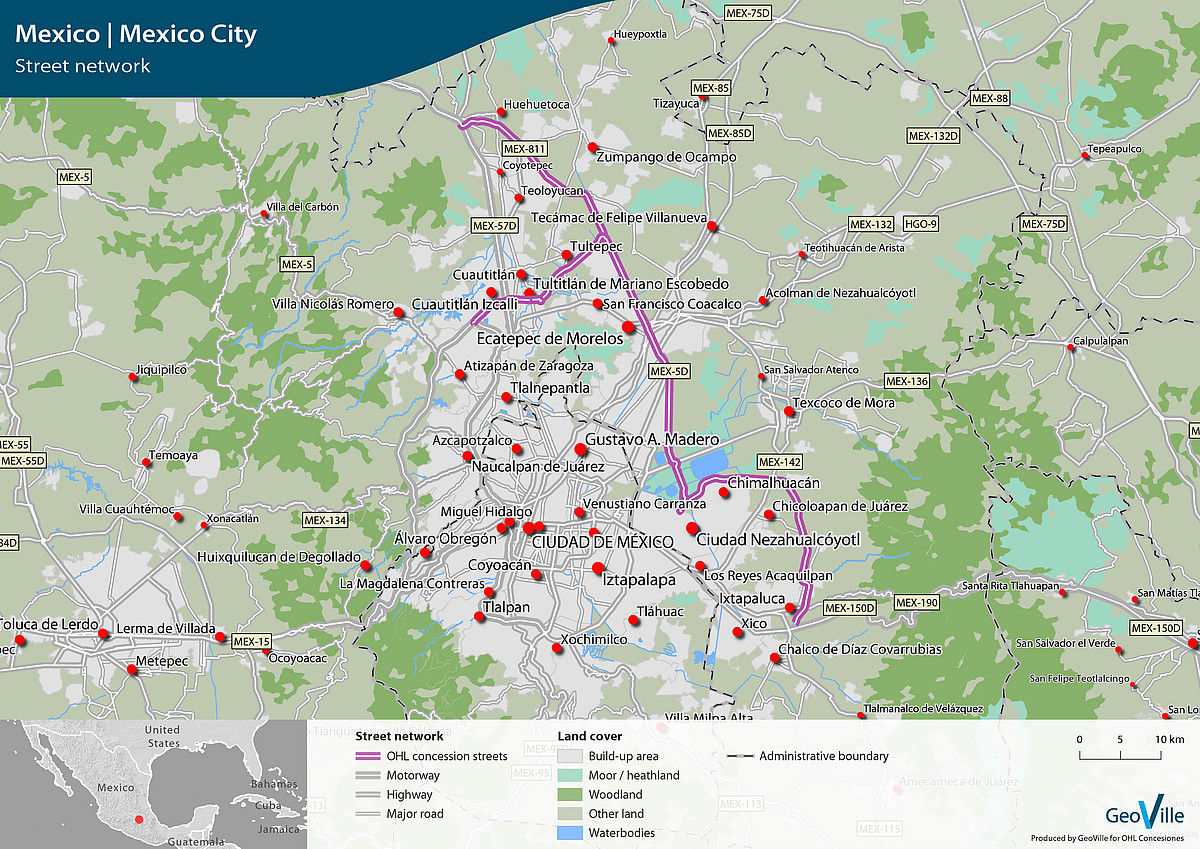
Mexico | Mexico City

Digital cartography of detailed highway network for digital web-map services of OHL Concesiones in South and Central Americas.

Success Story

Socio-economic and demographic analysis

2012, Brazil

Doppelmayr, global market leader for cable car solutions, developed a vision for an alternative urban ropeway transport system.

GeoVille was contracted to design and implement a method for assessing the global market potential along criteria of socio-demographic development, transport infrastructure, mobility, topography, points of interest and land use. The model provides quantitative measures of site potentials within cities at 100m spatial resolution and aggregates results to regional and national levels.

The resulting information is spatially explicit and allows identifying cities with the highest potential demand, countries with the largest market potential, and supports Doppelmayr in developing a highly efficient go-to-market strategy.

“Knowledge of the potential demand locations for cable propelled systems is key for Doppelmayr and the related geo-marketing activities. GeoVille proofed itself as a highly professional partner for establishing an information system solution answering complex market know-how challenges and questions.”

Johannes Winter, Doppelmayr

Continue

Get in touch

GeoVille Information Systems
and Data Processing GmbH

Sparkassenplatz 2
6020 Innsbruck
Austria

Tel: +43 512 562021-0
Fax: +43 512 562021-22
Email: info(at)geoville.com