Enabling
non-governmental
organisations

Solutions for NGOs

The impacts of climate change, depletion of natural resources, volatile conflicts and fast growing urban agglomerations represent enormous challenges for meeting “the 2030 Agenda for Sustainable Development”. Non-governmental organisations have an increasing role in international development, particularly in the fields of environmental protection, humanitarian assistance and poverty alleviation.

GeoVille provides solutions enabling non-governmental organisations to identify critical developments, qualify their activities, define priority areas for their actions and coordinate their work efficiently. Satellite Earth observation data and geospatial information technologies help to improve the management of natural and agricultural resources, understand and mitigate the effects of climate change and ensure civil security.


Our clients:

  • Environmental and humanitarian organisations
  • Smart City associations
  • Agricultural co-operations
  • Development agencies

We deliver ...

  • baseline information on land cover/land use change
  • early-warning indicators for environmental changes and humanitarian crises
  • continuous monitoring and assessment of mid- to long-term effects of environmental changes
  • crisis monitoring (water supplies, infrastructure, natural resources, food security) related to the entire management cycle from preparedness to response and risk reduction

Information Products

Prev Next

Mexico | Gulf of Mexico

Deepwater oil spill monitoring

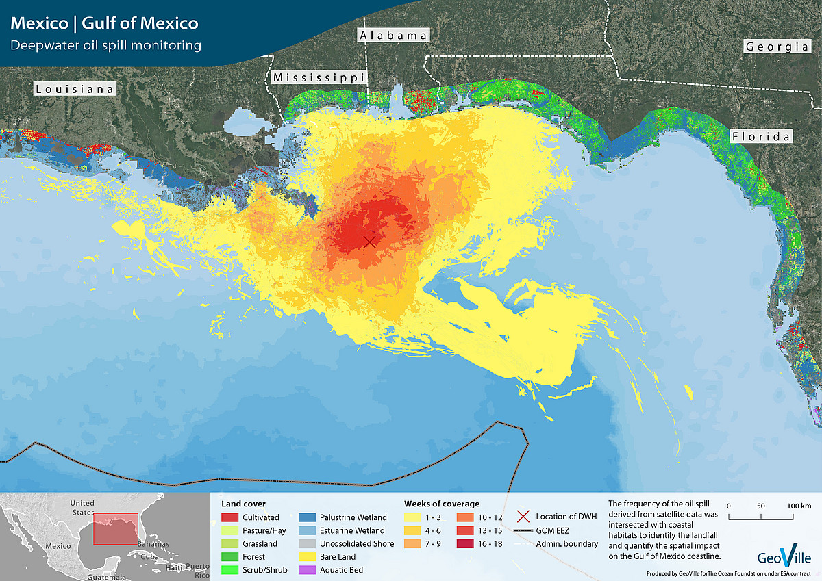
Mexico | Gulf of Mexico

Earth observation based assessment of the oil spill interaction with natural habitats after the Deepwater Horizon catastrophe. A statistical analyses was carried out for the affected shorelines in Louisiana, Mississippi, Alabama and western Florida.

Peru | San Martin

Natural capital assessment

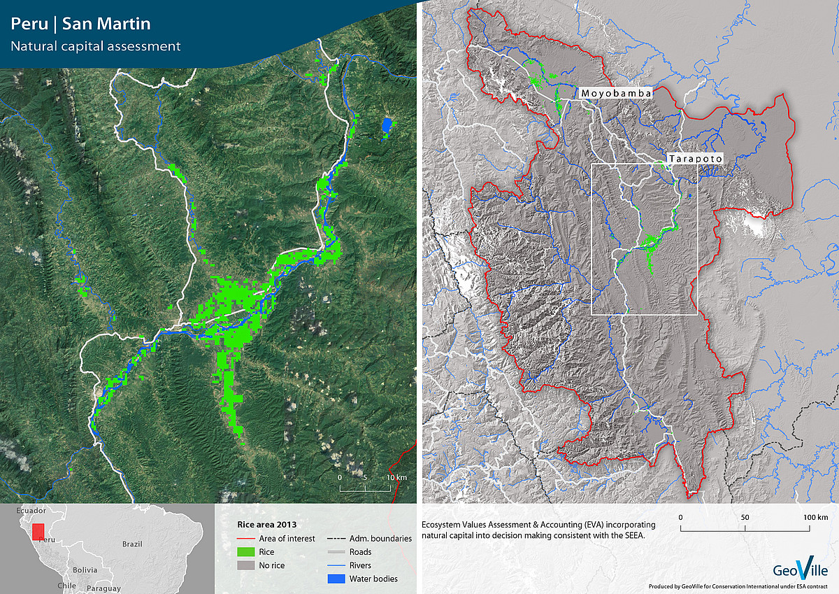
Peru | San Martin

Earth observation based monitoring of the extent and change of rice areas. Such information were used to support local water resources management, food security and the calculation of gas emission estimates.

Canada | Appalaches

Ecosystem monitoring

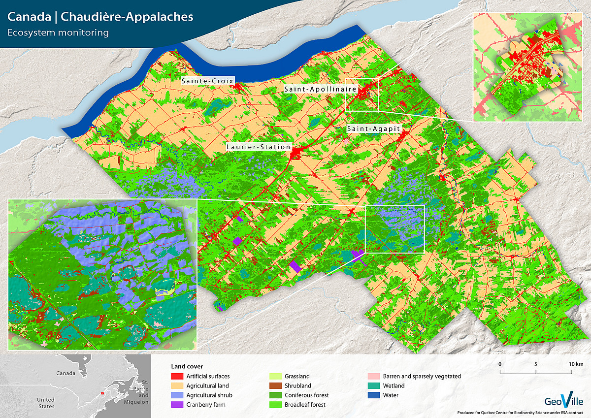
Canada | Appalaches

Earth observation based ecosystem assessment for the entire Chaudière-Appalaches region in Canada. Such information were used to protect the ecosystem functionalities and to estimate their value.

Success Story

2011, Cambodia

SOS Children’s Villages is an international non-governmental social development organisation that makes child care, education and health care available to children and their families.

GeoVille was commissioned to develop an Earth observation based Situational Awareness System (SAS) to support their services for planning, observing and monitoring of children’s villages worldwide. With the developed system, SOS Children’s Villages International is able to better analyse, manage and monitor site selection and development as well as use the derived information for improved fundraising activities and increase resource efficiency. The SAS gives a “global” view of SOS facilities to inform cooperation partners and donors about the progress that is made, for instance, in the construction of a new SOS Children’s Village.

“SOS Children‘s Villages is active in 133 countries working with 550 disadvantaged communities. Every year more than 10 new locations are added. With the help of Situational Awareness System we will be able to have more valid information for decision making.“

Michael Spuller, SOS Children‘s Villages International

Continue

Get in touch

GeoVille Information Systems
and Data Processing GmbH

Sparkassenplatz 2
6020 Innsbruck
Austria

Tel: +43 512 562021-0
Fax: +43 512 562021-22
Email: info(at)geoville.com