20
51
20
31
6
5
218
120
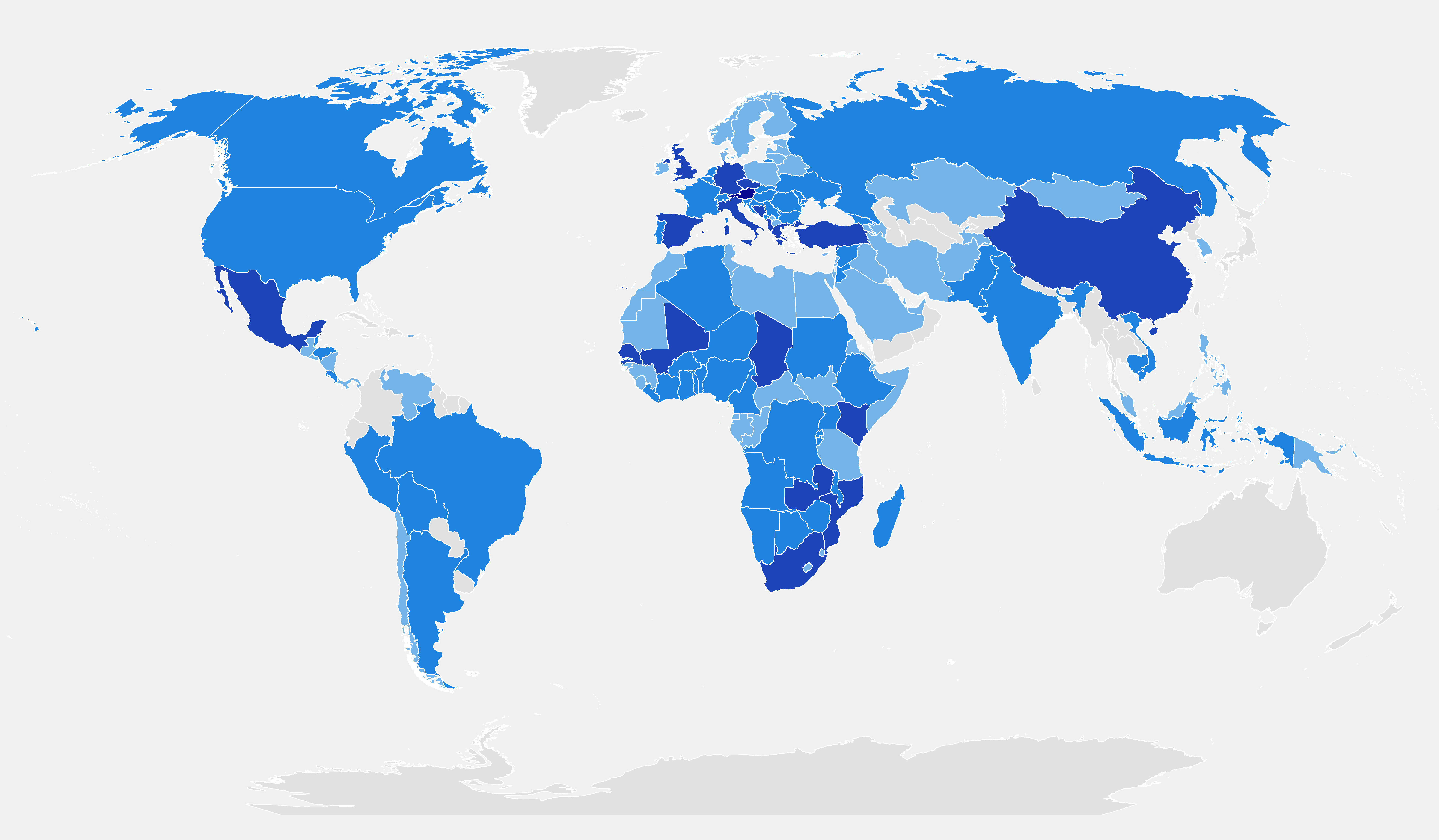
GeoVille is a globally-operating company. We have led or conducted many significant projects related to Earth observation data applications for large governmental and institutional organisations in Europe, America, Africa, the Middle East and Asia. Through our track record of over 470 successful projects, in over 140 countries worldwide, we have established a solid network of partners, clients and users.
For a quick overview of our service experience, please click on the continent of interest to get a list of sample project references by geographic area. By clicking on specific projects listed below, further insights about our developments, services and products are revealed.
For a full overview of our services and conducted projects please download our
Title
WorldWater
WorldWater
Surface Water Dynamics - Use of EO data for monitoring water resources
2020 - 2022
WIMAX
WIMAX
Establishment of satellite based land cover databases of greater urban areas
2005 - 2005
WIMAX
WIMAX
Establishment of satellite based land cover databases of greater urban areas
2005 - 2005
WIMAX
WIMAX
Establishment of satellite based land cover databases of greater urban areas
2005 - 2005
Wildbach, Montafon
Wildbach, Montafon
Visual interpretation of very high resolution satellite images and orthophotos to derive forest extent, density, species and age classes
2005 - 2005
WetMon
WetMon
Establish an operational wetland monitoring service based on Sentinel-1 observations providing users independ-ent access via web and mobile enabled data channels
2015 - 2016
WetMon
WetMon
Establish an operational wetland monitoring service based on Sentinel-1 observations providing users independ-ent access via web and mobile enabled data channels
2015 - 2016
West Africa Coastal Vulnerability
West Africa Coastal Vulnerability
Coastal change assessment
2011 - 2012
West Africa Coastal Vulnerability
West Africa Coastal Vulnerability
Coastal change assessment
2011 - 2012
West Africa Coastal Vulnerability
West Africa Coastal Vulnerability
Coastal change assessment
2011 - 2012
West Africa Coastal Vulnerability
West Africa Coastal Vulnerability
Coastal change assessment
2011 - 2012
West Africa Coastal Vulnerability
West Africa Coastal Vulnerability
Coastal change assessment
2011 - 2012
WB Liberia II
WB Liberia II
Update of the Liberia Land Cover and Forest Map
2018 - 2019
Vorarlberg Land Cover
Vorarlberg Land Cover
Land cover accounting, determination of recent land cover / land use and changes and population growth modeling to understand processes and trends in landscape developments
2004 - 2004
Vorarlberg Land Cover
Vorarlberg Land Cover
Revision of digital cadastre using automated orthophoto interpretation
2005 - 2005
Vietnam Risk
Vietnam Risk
Flood hazard and climate change risk potential maps and hazard profiles
2009 - 2009
Vegetation Dynamics
Vegetation Dynamics
Automatized, scale independent, high resolution, high temporal dynamic vegetation water content monitoring
2017 - 2018
Urbanisation Turkey
Urbanisation Turkey
Mapping of built-up areas and degree of urbanisation
2006 - 2006
Urbanisation Turkey
Urbanisation Turkey
Mapping of built-up areas and degree of urbanisation
2009 - 2009
Urbanisation Montenegro
Urbanisation Montenegro
Mapping of built-up areas and degree of urbanisation
2006 - 2006
Urbanisation Montenegro
Urbanisation Montenegro
Mapping of built-up areas and degree of urbanisation
2009 - 2009
Urbanisation BuH
Urbanisation BuH
Mapping of built-up areas and degree of urbanisation
2006 - 2006
Urbanisation BuH
Urbanisation BuH
Mapping of built-up areas and degree of urbanisation
2009 - 2009
UrbanAPI
UrbanAPI
Interactive Analysis, Simulation and Visualisation Tools for Urban Policy Implementation
2011 - 2014
UrbanAPI
UrbanAPI
Interactive Analysis, Simulation and Visualisation Tools for Urban Policy Implementation
2011 - 2014
UrbanAPI
UrbanAPI
Interactive Analysis, Simulation and Visualisation Tools for Urban Policy Implementation
2011 - 2014
UrbanAPI
UrbanAPI
Interactive Analysis, Simulation and Visualisation Tools for Urban Policy Implementation
2011 - 2014
Urban Shanghai
Urban Shanghai
Urban monitoring and analyses on the changes of the built-up area
1999 - 2000
Urban Istanbul
Urban Istanbul
Urban planning Istanbul
2013 - 2013
Urban Growth Modelling
Urban Growth Modelling
Urban growth modeling based on satellite land cover mapping to predict future patterns of urbanisation and development of climate change adaptation strategies
2008 - 2012
Urban Growth Modelling
Urban Growth Modelling
Urban growth modeling based on satellite land cover mapping to predict future patterns of urbanisation and development of climate change adaptation strategies
2008 - 2012
Urban Growth Modelling
Urban Growth Modelling
Urban growth modeling based on satellite land cover mapping to predict future patterns of urbanisation and development of climate change adaptation strategies
2008 - 2012
Urban Growth Modelling
Urban Growth Modelling
Urban growth modeling based on satellite land cover mapping to predict future patterns of urbanisation and development of climate change adaptation strategies
2008 - 2012
Urban Growth Modelling
Urban Growth Modelling
Urban growth modeling based on satellite land cover mapping to predict future patterns of urbanisation and development of climate change adaptation strategies
2008 - 2012
Urban Growth Modelling
Urban Growth Modelling
Urban growth modeling based on satellite land cover mapping to predict future patterns of urbanisation and development of climate change adaptation strategies
2008 - 2012
Urban Growth Modelling
Urban Growth Modelling
Urban growth modeling based on satellite land cover mapping to predict future patterns of urbanisation and development of climate change adaptation strategies
2008 - 2012
Urban Growth Modelling
Urban Growth Modelling
Urban growth modeling based on satellite land cover mapping to predict future patterns of urbanisation and development of climate change adaptation strategies
2008 - 2012
Urban Growth Modelling
Urban Growth Modelling
Urban growth modeling based on satellite land cover mapping to predict future patterns of urbanisation and development of climate change adaptation strategies
2008 - 2012
Urban Growth Modelling
Urban Growth Modelling
Urban growth modeling based on satellite land cover mapping to predict future patterns of urbanisation and development of climate change adaptation strategies
2008 - 2012
Urban Growth Modelling
Urban Growth Modelling
Urban growth modeling based on satellite land cover mapping to predict future patterns of urbanisation and development of climate change adaptation strategies
2008 - 2012
Urban environment Vietnam
Urban environment Vietnam
Production of Earth Observation-based information products and services for two coastal cities (Dong Hoi and Hoi An)
2014 - 2015
urban atlas spain
urban atlas spain
Establishment of satellite based high resolution urban atlas
2007 - 2007
Urban Atlas
Urban Atlas
2023 - 2027
UN Syria
UN Syria
Biodiversity and degradation assessment in drylands
2012 - 2014
Triest corridor impact assessment
Triest corridor impact assessment
Corridor impact assessment along the trans-European corridor V near the Italian city of Trieste
2007 - 2009
Transport planning
Transport planning
GIS based public transport planning and development of dedicated GI tools
2003 - 2003
Toll roads Mexico
Toll roads Mexico
Mapping of new toll roads
2011 - 2012
TIGER-NET
TIGER-NET
Hydrological water discharge modelling and flood forecasting
2012 - 2015
TIGER-NET
TIGER-NET
Land cover change and land degradation mapping
2012 - 2015
TIGER-NET
TIGER-NET
Land cover change and land degradation mapping
2012 - 2015
TIGER-NET
TIGER-NET
Small water body mapping and seasonal/longterm monitoring
2012 - 2015
TIGER-NET
TIGER-NET
Historical flood mapping
2012 - 2015
TIGER-NET
TIGER-NET
Land cover change and land degradation mapping
2012 - 2015
TIGER-NET
TIGER-NET
Lake Chad historical lake monitoring and related land cover change mapping
2012 - 2015
TIGER-NET
TIGER-NET
Historical flood mapping
2012 - 2015
TIGER-NET
TIGER-NET
Hydrological water discharge modelling
2012 - 2015
TIGER-NET
TIGER-NET
Lake Chad historical lake monitoring and related land cover change mapping
2012 - 2015
TIGER-NET
TIGER-NET
Land degradation mapping
2012 - 2015
TIGER-NET
TIGER-NET
Sanitation planning, N'Djamena
2012 - 2015
TIGER-NET
TIGER-NET
Land cover change and land degradation mapping
2012 - 2015
TIGER-NET
TIGER-NET
Capacity Building & Training in utilization of the Water Observation and Information System for land degradation monitoring to support IWRM
2012 - 2015
TIGER-NET
TIGER-NET
Historical flood mapping
2012 - 2015
TIGER-NET
TIGER-NET
Land cover change and land degradation mapping
2012 - 2015
TIGER-NET
TIGER-NET
Soil erosion potential mapping
2012 - 2015
TIGER-NET
TIGER-NET
Land cover change and land degradation mapping
2012 - 2015
TIGER-NET
TIGER-NET
Flood vulnerability mapping
2012 - 2015
TIGER-NET
TIGER-NET
Hydrological water discharge modelling and flood forecasting
2012 - 2015
TIGER-NET
TIGER-NET
Near-real time flood monitoring
2012 - 2015
TIGER-NET
TIGER-NET
Historical flood mapping
2012 - 2015
TIGER-NET
TIGER-NET
Land cover change and land degradation mapping
2012 - 2015
TIGER-NET
TIGER-NET
Land cover change related water demand modelling
2012 - 2015
TIGER-NET
TIGER-NET
Historical flood mapping
2012 - 2015
TIGER-NET
TIGER-NET
Wetland Mapping and seasonal/longterm monitoring
2012 - 2015
TIGER-NET
TIGER-NET
Land cover change and land degradation mapping
2012 - 2015
TIGER-NET
TIGER-NET
Historical flood mapping
2012 - 2015
TIGER-NET
TIGER-NET
Near-real time flood monitoring
2012 - 2015
TIGER-NET
TIGER-NET
Soil erosion potential mapping
2012 - 2015
TIGER-NET
TIGER-NET
Land cover change and land degradation mapping
2012 - 2015
TIGER-NET
TIGER-NET
Land cover change and land degradation mapping
2012 - 2015
TIGER-NET
TIGER-NET
Small water body mapping and seasonal/longterm monitoring
2012 - 2015
TIGER-NET
TIGER-NET
Hydrological water discharge modelling and flood forecasting
2012 - 2015
TIGER Bridge
TIGER Bridge
Continuing and further advancing the antecedent efforts of ESA in the TIGER Initiative, which contributed to capacity development in the African water sector for the application of EO
2015 -
Telegdy
Telegdy
Engineering support for sanitary systems design
2001 - 2001
TelecomOperator
TelecomOperator
Provision of land cover databases for radio communication network planning
2010 - 2010
Telecom
Telecom
Provision of land cover databases for radio communication network planning
2004 - 2004
Telecom
Telecom
Provision of land cover databases for radio communication network planning
2006 - 2006
T-Mobile Austria II
T-Mobile Austria II
Production of clutter data for Austria & surrounding
2017 - 2017
T-Mobile Austria I
T-Mobile Austria I
Production of clutter data for Austria & surrounding
2016 - 2017
Subsidence
Subsidence
Radar satellite based subsidence monitoring
2008 - 2008
SOS Children Villages
SOS Children Villages
Construction Monitoring
2011 - 2013
SOS Children Villages
SOS Children Villages
Community Development
2011 - 2013
SOS Children Villages
SOS Children Villages
Rapid Awareness Assessment
2011 - 2013
SoilSAGE
SoilSAGE
GSE Stage 1 project task manager of SoilSAGE
2002 - 2005
Soil sealing Europe
Soil sealing Europe
Establishment of satellite based soil sealing map of Europe
2007 - 2008
Socio-economic and demographic analysis
Socio-economic and demographic analysis
2012 - 2012

Doppelmayr, global market leader for cable car solutions, developed a vision for an alternative urban ropeway transport system.
GeoVille was contracted to design and implement a method for assessing the global market potential along criteria of socio-demographic development, transport infrastructure, mobility, topography, points of interest and land use. The model provides quantitative measures of site potentials within cities at 100m spatial resolution and aggregates results to regional and national levels.
The resulting information is spatially explicit and allows identifying cities with the highest potential demand, countries with the largest market potential, and supports Doppelmayr in developing a highly efficient go-to-market strategy.
“Knowledge of the potential demand locations for cable propelled systems is key for Doppelmayr and the related geo-marketing activities. GeoVille proofed itself as a highly professional partner for establishing an information system solution answering complex market know-how challenges and questions.”
Johannes Winter, Doppelmayr
Smarticipate
Smarticipate
smarticipate is a data-rich citizen dialogue system, transforming public data into new intelligence, and transposing elements of intelligent ICT development to urban governance
2015 -
Smarticipate
Smarticipate
smarticipate is a data-rich citizen dialogue system, transforming public data into new intelligence, and transposing elements of intelligent ICT development to urban governance
2013 -
Smarticipate
Smarticipate
smarticipate is a data-rich citizen dialogue system, transforming public data into new intelligence, and transposing elements of intelligent ICT development to urban governance
2014 -
SmartCO2
SmartCO2
Towards Smart EO Services for CO2 Inventorying & Control
2021 - 2022
Smart Connect – Civil Security from Space
Smart Connect – Civil Security from Space
2023 - 2026
SM4TIGER
SM4TIGER
Provision of access to both the GMFS-Soil Moisture services and the WOIS to the GMFS and TIGER community and expansion of the user community
2013 - 2015
Situationalawareness system
Situationalawareness system
Development of an Earth observation based Situational Awareness System (SAS) to support their services for planning, observing and monitoring of children’s villages worldwide
2011 - 2013
SIGMA
SIGMA
Methods and Indicators for measuring the progress towards sustainable agriculture; impacts of crop production
2013 - 2017
SIGMA
SIGMA
Methods and Indicators for measuring the progress towards sustainable agriculture; impacts of crop production
2013 - 2017
SIGMA
SIGMA
Methods and Indicators for measuring the progress towards sustainable agriculture; impacts of crop production
2013 - 2017
SIGMA
SIGMA
Methods and Indicators for measuring the progress towards sustainable agriculture; impacts of crop production
2013 - 2017
SIGMA
SIGMA
Methods and Indicators for measuring the progress towards sustainable agriculture; impacts of crop production
2013 - 2017
SIGMA
SIGMA
Methods and Indicators for measuring the progress towards sustainable agriculture; impacts of crop production
2013 - 2017
SIGMA
SIGMA
Methods and Indicators for measuring the progress towards sustainable agriculture; impacts of crop production
2013 - 2017
SIGMA
SIGMA
Methods and Indicators for measuring the progress towards sustainable agriculture; impacts of crop production
2013 - 2017
SIGMA
SIGMA
Methods and Indicators for measuring the progress towards sustainable agriculture; impacts of crop production
2013 - 2017
SIGMA
SIGMA
Methods and Indicators for measuring the progress towards sustainable agriculture; impacts of crop production
2013 - 2017
SIGMA
SIGMA
Methods and Indicators for measuring the progress towards sustainable agriculture; impacts of crop production
2013 - 2017
Siemens
Siemens
Land cover databases for radio communication network planning
2001 - 2001
Siemens
Siemens
Land cover databases for radio communication network planning
2007 - 2007
Sewage system
Sewage system
Sewage system planning
2002 - 2002
Settlement mapping Vorarlberg
Settlement mapping Vorarlberg
Orthophoto based settlement mapping
2006 - 2007
Serbia Master plan
Serbia Master plan
Master plans and change analysis to monitor illegal housing, urban growth and plan new housing developments
2000 - 2001
Seoul land cover
Seoul land cover
Land cover database of Seoul and sourroundings
2002 - 2003
Sentinel-2 Global Mosaic (S2GM)
Sentinel-2 Global Mosaic (S2GM)
Copernicus Sentinel-2 Global Mosaic (S2GM) within the Global Land Component of the Copernicus Land Service; Lot 1 - Production and distribution of the Sentinel-2 Global Mosaic
2017 - 2019
SENSA
SENSA
Sustainable, Environmental, and Safe Tourism in Protected Areas
2013 - 2015
SENSA
SENSA
Sustainable, Environmental, and Safe Tourism in Protected Areas
2016 - 2018
SENSA
SENSA
Sustainable, Environmental, and Safe Tourism in Protected Areas
2016 - 2018
SENSA
SENSA
Sustainable, Environmental, and Safe Tourism in Protected Areas
2013 - 2015
SENSA
SENSA
Sustainable, Environmental, and Safe Tourism in Protected Areas
2016 - 2018
Sealing Cadastre Trento
Sealing Cadastre Trento
Orthophoto based mapping of sealing cadastre
2004 - 2004
Sealing Cadastre Traisental
Sealing Cadastre Traisental
Orthophoto based mapping of sealing cadastre
2004 - 2004
ScaleFloodS
ScaleFloodS
2023 - 2026
Satellitenbildauswertung Weser-EMS
Satellitenbildauswertung Weser-EMS
Satellite based assessment of land consumption and soil sealing impact (including flood risk)
2007 - 2007
SAFETrail
SAFETrail
2021 - 2022
Royal Dutch army
Royal Dutch army
Generation of a digital database of the Netherlands for flight simulation
2003 - 2003
Riverbed extraction
Riverbed extraction
EO-Based Services for Management of International River Systems: River bed extraction
2013 - 2014
Riparian Zones
Riparian Zones
Earth Observation based land monitoring and assessment of riparian ecosystems and their services
2014 - 2015
Rhode&Schwartz
Rhode&Schwartz
Land cover databases for radio communication network planning
2000 - 2000
Renewable energy potential maps for the West Balkan Countries
Renewable energy potential maps for the West Balkan Countries
Renewable energy potential maps
2009 - 2010
Renewable energy potential maps for the West Balkan Countries
Renewable energy potential maps for the West Balkan Countries
Renewable energy potential maps
2009 - 2010
RAPIDEM
RAPIDEM
Rapid assessment for intelligent disaster and emergency management
2012 - 2012
RAMONA - Rangeland Monitoring for Africa
RAMONA - Rangeland Monitoring for Africa
2021 - 2023
QuinJunSat
QuinJunSat
Improved Situational Awareness during Crisis Events through integration of Crowdsourced Data with Satellite derived Information
2017 - 2018
Prepare4EODC
Prepare4EODC
Preparing for the initial services of the Earth Observation Data Centre (EODC), founded by the consortium mem-bers, for Water Resources Monitoring
2014 - 2015
Potential mapping
Potential mapping
Interpretation of land cover and site potential mapping for planning of tourism facilities
2003 - 2003
Population maps Russia
Population maps Russia
Population maps
2010 - 2010
Population distribution China
Population distribution China
Population distribution
2007 - 2009
PopLoc
PopLoc
Development and production of day and night population locator product
2009 - 2010
Pilot Extraction Gebäudedaten (2574)
Pilot Extraction Gebäudedaten (2574)
Building footprint mapping
2008 - 2008
Perceptive Sentinel
Perceptive Sentinel
PerceptiveSentinel project delivers a PerceptiveSentinel platform - an INTERMEDIATE EO service that will through seamless provide access to highly pre-processed DATA
2017 - 2019
OXYGEN
OXYGEN
Preparation of presentation material on OXYGEN for the Paris Le Bourget Air and Space Show.
2004 - 2004
Oil palm biomasspower potential
Oil palm biomasspower potential
Assessment of oil palm biomass potential in rural communities in Liberia as a baseline for the planning of mini-grid investment projects for rural electrification
2016 - 2016

Liberia’s rural-community oil palm production offers the opportunity to deliver enough woody biomass for small off grid electricity production. In 2016, GOPA, an independent private consultant company, commissioned GeoVille to assess the oil palm biomass potential in rural communities in Liberia as a baseline for the planning of mini-grid investment projects for rural electrification.
A satellite-based forest inventory, including the delineation of industrial and community-based oil palm and rubber tree plantations, was produced by GeoVille. Using a satellite-based digital surface and terrain model to derive absolute above-ground vegetation height, the above-ground biomass was modelled using state-of-the art methods. GIS techniques were applied to map and quantify the biomass potential for communities in selected counties.
Oil Accident Africa
Oil Accident Africa
Impact assessment for an oil accident
2012 - 2013
Oil & Gas
Oil & Gas
Geo-information needs & EO capabilities for the Oil & Gas Sector
2014 - 2014
Oil & Gas
Oil & Gas
Geo-information needs & EO capabilities for the Oil & Gas Sector
2014 - 2014
Oil & Gas
Oil & Gas
Geo-information needs & EO capabilities for the Oil & Gas Sector
2014 - 2014
Oil & Gas
Oil & Gas
Geo-information needs & EO capabilities for the Oil & Gas Sector
2014 - 2014
Oil & Gas
Oil & Gas
Geo-information needs & EO capabilities for the Oil & Gas Sector
2014 - 2014
Oil & Gas
Oil & Gas
Geo-information needs & EO capabilities for the Oil & Gas Sector
2014 - 2014
Oil & Gas
Oil & Gas
Geo-information needs & EO capabilities for the Oil & Gas Sector
2014 - 2014
Oil & Gas
Oil & Gas
Geo-information needs & EO capabilities for the Oil & Gas Sector
2014 - 2014
Oil & Gas
Oil & Gas
Geo-information needs & EO capabilities for the Oil & Gas Sector
2014 - 2014
Oil & Gas
Oil & Gas
Geo-information needs & EO capabilities for the Oil & Gas Sector
2014 - 2014
Network planning
Network planning
Provision of land cover databases for radio communication network planning
2008 - 2008
NEOS-QUICK
NEOS-QUICK
GMES Preparatory Project NEOS-QUICK project coordinator.
2006 - 2007
National Park Sao Tome and Principe
National Park Sao Tome and Principe
Assessment of the impact of climate change on specific areas of interest at the coasts of Sao Tomé and Príncipe
2016 -
Monte-Carlo simulaiton
Monte-Carlo simulaiton
Radar satellite based flood impact mapping employing Monte-Carlo simulation models
2002 - 2002
Meris Mosaic
Meris Mosaic
Generation of a seamless image mosaic based on ENVISAT-MERIS covering the entire EU territory
2006 - 2006
Mekong river basin exposure mapping
Mekong river basin exposure mapping
Urban and crop mapping to contribute to the Mekong Integrated Water Resources Management
2011 - 2012
Lux Land Cover
Lux Land Cover
Defintion of land cover update specifications and validation of results
2008 - 2008
Lower Austria soil sealing
Lower Austria soil sealing
Generation of sealing and change masks for the State of Lower Austria
2002 - 2002
LISA II
LISA II
Further development of the Land Information System for Austria (LISA)
2010 - 2010
LISA
LISA
Conception and Demonstration of an Land Information System for Austria (LISA)
2009 - 2010
Linear Features Europe
Linear Features Europe
Development of EO derived information services for EEA: Linear features structure landscapes
2011 - 2013
Liberia Forestry Classification
Liberia Forestry Classification
Forest change and degradation monitoring
2012 - 2012
Liberia Forest Resource and Mapping
Liberia Forest Resource and Mapping
Land allocation planning
2012 - 2012
Liberia Forest and Land Cover Mapping
Liberia Forest and Land Cover Mapping
Forest and land cover change mapping
2014 - 2015
Law enforcementand governance
Law enforcementand governance
Establishment of a satellite based method for assessing forest-dependent communities with respect to climate change, resource depletion and deforestation.
2014 - 2015

Forest resources are important for improving rural community well-being and alleviating the impacts of poverty. The International Union for Conservation (IUCN) commissioned GeoVille to establish a satellite based method for assessing forest-dependent communities with respect to climate change, resource depletion and deforestation. GeoVille developed the ‘Forest Community Fingerprint’ as a cost-effective tool to more accurately estimate the human-nature dependency structure in these forest ecosystems and to document drivers of sustainability and efficiency of interactions between communities and their surrounding resources. The system statistically links in-situ surveys with geospatial Earth observation data to predict relationships between forest dependency and the community’s geographic and demographic context.
In the long run, the developed Earth observation capacity will support IUCN to enable an early identification of forest-dependent communities at risk of reduced adaptive capacity to climate change.
“The use of EO provided the means for IUCN to identify forest change and to help add another layer of information to our ‘basket’ regarding forest use and resource depletion. This information is especially critical in remote, difficult-to-reach geographies.”
Richard Aishton, IUCN – ENPI FLEG
LandSTATS EO
LandSTATS EO
Development of an early prototype land dynamics information service based on further advanced cloud services,new machine learning methods with data stream access through statistical analysis software’s via application programming interfaces (API) via the Austrian Data Cube hosted at EODC
2019 - 2021
Landslide
Landslide
Landslide risk assessment
2010 - 2010
LandSense
LandSense
Build an innovative citizen observatory in the field of LULC, which collects data both actively and passively and integrates them into an open platform
2016 -
LandMon
LandMon
Development of processing methods for pan-European land monitoring data
2014 - 2016
Land Use, Land Use Change and Forestry (LULUCF)
Land Use, Land Use Change and Forestry (LULUCF)
Technical Assistance for Developed Analytical Basis for Land Use, Land Use Change and Forestry (LULUCF) Sector
2017 - 2019
Land Information System Austria
Land Information System Austria
Achievement of a national consensus on how to perform a continuous mapping of the national land cover and monitor its change
2016 - 2017

In order to meet the reporting obligations from international conventions, European directives and national legislations, countries are required to produce up to date, detailed and harmonised information on their land cover and its use, at different scales and for different domains of applications. Although Europe can build upon a long experience of land cover and land use mapping, most of the existing national datasets respond to different needs and have been produced with differing standards and methodologies, thus lacking comparability across sectors and are in many cases outdated.
In 2010, GeoVille was commissioned to implement the Land Information System Austria (LISA), with the objective to achieve a national consensus on how to perform a continuous mapping of the national land cover and monitor its change. The aim was to reduce the existing lack of information of different fields such as spatial planning, forestry, agriculture, water and natural hazard management, as well as environmental protection and conservation. Today, the homogenous and seamless land cover product covers an area of 84,000 km² and is available for the year 2016. Its the first available nationwide Sentinel-2 based land cover map.
The full system implementation was funded by the Federal Ministry for Transport, Innovation and Technology (bmvit) through the Austrian Space Applications Programme (ASAP) as well as the European Space Agency (ESA).
"The products derived to monitor land cover and it's changes using Sentinel-2 images provide a substantial new understanding of short-, medium- and long-term changes and their influence on habitat development. These new insights will be a key element to improve our sustainable management of key natural resources [...].”
Gebhard Banko
Land cover database
Land cover database
Establishment of satellite based land cover database
2005 - 2005
Land cover database
Land cover database
Establishment of satellite based land cover database
2003 - 2003
Land cover database
Land cover database
Establishment of satellite based land cover database
2003 - 2003
Land cover database
Land cover database
Establishment of satellite based land cover database
2006 - 2006
Land cover database
Land cover database
Land cover database
2004 - 2004
Land cover database
Land cover database
Establishment of satellite based land cover database
2003 - 2003
LACOVAL
LACOVAL
Development of an on-line land cover validation tool
2012 - 2013
LACO-Wiki
LACO-Wiki
Integration of LACOVAL (LAnd COver VALidation) software prototype for the validation of land cover data with Geo-Wiki into an open access online validation platform
2014 - 2016
Kruger National Park
Kruger National Park
Kruger National Park Monitoring
2000 - 2000
Kraisbau – Entwicklung von KI-Werkzeugen für eine Transformation zu einer Kreislaufwirtschaft
Kraisbau – Entwicklung von KI-Werkzeugen für eine Transformation zu einer Kreislaufwirtschaft
2024 - 2028
Konzeptstudie Geographische Marktpotenzialanalyse
Konzeptstudie Geographische Marktpotenzialanalyse
Socio-economic and demographic analysis
2012 - 2012
Konzeptstudie Geographische Marktpotenzialanalyse
Konzeptstudie Geographische Marktpotenzialanalyse
Socio-economic and demographic analysis
2012 - 2012
Konzeptstudie Geographische Marktpotenzialanalyse
Konzeptstudie Geographische Marktpotenzialanalyse
Socio-economic and demographic analysis
2012 - 2012
Kärnten&Vorarlberg land cover
Kärnten&Vorarlberg land cover
Generation of built-up and land cover change maps for the States of Carinthia and Vorarlberg, combined with statistical and demographic analyses
2001 - 2001
JRC Global Land Cover and Tropical Forest Mapping and Monitoring
JRC Global Land Cover and Tropical Forest Mapping and Monitoring
2023 - 2025
JRC EO Training
JRC EO Training
Training Manual on Earth Observation For Decision Makers.
1999 - 1999
iReact
iReact
Improving Resilience to Emergencies through Advanced Cyber Technologies.
2016 -
InfraBase
InfraBase
Develop and verify algorithmic components to enable machine interaction-based detection and delineations of buildings
2018 - 2019
Information Factory Pathfinder: Drought/Irrigation Indicators for Danube Region
Information Factory Pathfinder: Drought/Irrigation Indicators for Danube Region
2023 - 2025
Informal Settlement Mapping
Informal Settlement Mapping
2023 - 2024
Informal Housing Nigeria
Informal Housing Nigeria
Mapping and monitoring of informal housing developments using Very High Resolution Satellite data
2007 - 2007
Inflight Training simulator
Inflight Training simulator
Production of an image and 3D database for integration in an inflight training simulator
2002 - 2002
IncREO
IncREO
Increasing resilience to floods
2012 - 2015
IFI Water
IFI Water
Use of EO based services to measure technical and financial investments in developing countries to reduce poverty and increase economic growth
2016 -
IFI Climate Resilience
IFI Climate Resilience
Provide data-driven environment enabling an easy and rapid integrated climate screening and risk management approach (e.g. EO-based climate indicators, agile prototyping of higher-level EO products)
2018 - 2021
IFI Agriculture
IFI Agriculture
Use of EO based services to measure technical and financial investments in developing countries to reduce poverty and increase economic growth
2016 -
IFAD Senegal
IFAD Senegal
Index insurance
2013 - 2015
IFAD EODM
IFAD EODM
Enable rural communities to utilize high impact and low cost products and services derived from satellite data, and create data driven base for agricultural growth and impact investing opportunities
2016 -
ICT Siemens
ICT Siemens
Land cover databases for radio communication network planning
2006 - 2006
ICT EuropeAid
ICT EuropeAid
Multiple Framework contract for the provision GIS services in the telecommunications and information
technologies sector
2009 - 2014
ICT Czech Republic
ICT Czech Republic
Provision of land cover databases for radio communication network planning
2009 - 2009
HRL Copernicus land cover/land use
HRL Copernicus land cover/land use
The Natura 2000 network of protected sites covers about 18% of the EU’s land area and is the main policy strategy to address biodiversity conservation in Europe.
2015 - 2015

The Natura 2000 network of protected sites covers about 18% of the EU’s land area and is the main policy strategy to address biodiversity conservation in Europe.
In 2016, GeoVille was, as part of a consortium, contracted by the European Environment Agency (EEA) to map a selection of Natura 2000 sites in order to assess their development over time for the 2006-2012 period - especially in view of quantitative/qualitative changes of certain natural/semi-natural grassland types, and an analysis of pressures and threats which impact the Natura 2000 sites and habitats. It is to complement and continue the previous mapping and analysis work undertaken by the GIO/Copernicus Initial Operations.
The results enable an assessment of the effectiveness of the Natura 2000 network on a European scale, specifically for investigating its effectiveness in halting the decline of important grassland habitat types across Europe.
HQ-S2
HQ-S2
generate advanced pre-processing algorithms for S-2 data and produce long time series of high quality images corrected of cloud effects and atmospheric noise built from combined Landsat-8 and S-2 scenes
2016 -
Honduras Land Use Change
Honduras Land Use Change
Assessment of forest clearing and degradation for land parcel management
2009 - 2009
HochTief
HochTief
Construction monitoring
2009 - 2009
HochTief
HochTief
Construction monitoring
2009 - 2009
HochTief
HochTief
Burj Khalifa Construction monitoring
2009 - 2009
Highway operation
Highway operation
Large scale European field operational test on safe, intelligent and sustainable highway operation.
2011 - 2013
Highway monitoring
Highway monitoring
Radar satellite based highway monitoring
2009 - 2009
High Sens II
High Sens II
Highly versatile, new satellite sensor applications
2013 - 2014
High Resolution Layer – Non-Vegetated Land Cover Characteristics
High Resolution Layer – Non-Vegetated Land Cover Characteristics
2023 - 2024
High resolution land cover CCI+
High resolution land cover CCI+
Study and investigate the role of the spatial resolution of Land Cover and its changes in supporting climate modelling research at regional scale
2019 - 2021
High Resolution Coastal Maps
High Resolution Coastal Maps
Coastal change assessment
2012 - 2013
HELM
HELM
Support to HELM in the development of a future-oriented model for Harmonised European Land Monitoring
2011 - 2013
HeatMon
HeatMon
2023 - 2024
HeatAdapt
HeatAdapt
2023 - 2024
Harvic
Harvic
2020 - 2021
GSE-SAGE
GSE-SAGE
Development and application of spatial indicators for land consumption within the GSE - SAGE and GSE – Land projects
2007 - 2007
GSE-SAGE
GSE-SAGE
Development and application of spatial indicators for land consumption within the GSE - SAGE and GSE – Land projects
2007 - 2007
GSE-SAGE
GSE-SAGE
Development and application of spatial indicators for land consumption within the GSE - SAGE and GSE – Land projects
2007 - 2007
GSE Land
GSE Land
GSE Stage 2 Project task manager on the “Impervious areas and sealing levels” and responsible for service implementation in 10 European countries
2005 - 2008
Grünflächenplan Linz
Grünflächenplan Linz
Orthophoto based high resolution mapping of green urban spaces
2009 - 2009
Green Landscape Elements
Green Landscape Elements
Satellite based mapping of important green landscape elements
2012 - 2014
GNU
GNU
Support of GMES Network of Users (GNU) in expressing the user's understanding of the GMES process
2007 - 2010
GMFS Soil Moisture Extension
GMFS Soil Moisture Extension
Extending the Global Monitoring for Food Security (GMFS) Soil Moisture Indicators Service to the TIGER-NET Water Observation and Information System
2013 - 2015
GMFS Soil Moisture Extension
GMFS Soil Moisture Extension
Extending the Global Monitoring for Food Security (GMFS) Soil Moisture Indicators Service to the TIGER-NET Water Observation and Information System
2013 - 2015
GMFS Soil Moisture Extension
GMFS Soil Moisture Extension
Extending the Global Monitoring for Food Security (GMFS) Soil Moisture Indicators Service to the TIGER-NET Water Observation and Information System
2013 - 2015
GMFS Soil Moisture Extension
GMFS Soil Moisture Extension
Extending the Global Monitoring for Food Security (GMFS) Soil Moisture Indicators Service to the TIGER-NET Water Observation and Information System
2013 - 2015
GMFS
GMFS
Early warning for food security
2010 - 2013
GMFS
GMFS
Early warning for food security
2010 - 2013
GMFS
GMFS
Early warning for food security
2010 - 2013
GMFS
GMFS
Early warning for food security
2010 - 2013
GMFS
GMFS
Early warning for food security
2010 - 2013
GMFS
GMFS
Early warning for food security
2010 - 2013
GMFS
GMFS
Early warning for food security
2010 - 2013
GMFS
GMFS
Early warning for food security
2010 - 2013
GMES Initial Operations (GIO), Lot 4
GMES Initial Operations (GIO), Lot 4
High resolution layers on land cover characteristics (imperviousness and forest) for GMES Initial Operations Land Monitoring
2011 - 2015
GMES Initial Operations (GIO), Lot 1
GMES Initial Operations (GIO), Lot 1
High resolution layer on land cover characteristics (imperviousness) for GMES Initial Operations Land Monitoring
2011 - 2015
GMES Initial Operations (GIO) Lot 5
GMES Initial Operations (GIO) Lot 5
Mapping of built-up areas, degree of urbanisation and forest coverage
2012 - 2015
GMES Initial Operations (GIO) Lot 4
GMES Initial Operations (GIO) Lot 4
Mapping of built-up areas, degree of urbanisation and forest coverage
2012 - 2015
GMES Initial Operations (GIO) Lot 4
GMES Initial Operations (GIO) Lot 4
Mapping of built-up areas, degree of urbanisation and forest coverage
2012 - 2015
GMES FastTrack Service
GMES FastTrack Service
GMES FastTrack Service: Mapping of built-up areas and degree of soil sealing
2008 - 2009
GMES FastTrack Service
GMES FastTrack Service
GMES FastTrack Service: Mapping of built-up areas and degree of soil sealing
2008 - 2009
GMES FastTrack Service
GMES FastTrack Service
GMES FastTrack Service: Mapping of built-up areas and degree of soil sealing
2008 - 2009
GMES FastTrack Service
GMES FastTrack Service
GMES FastTrack Service: Mapping of built-up areas and degree of soil sealing
2008 - 2009
GMES FastTrack Service
GMES FastTrack Service
GMES FastTrack Service: Mapping of built-up areas and degree of soil sealing
2008 - 2009
GMES FastTrack Service
GMES FastTrack Service
GMES FastTrack Service: Mapping of built-up areas and degree of soil sealing
2008 - 2009
GMES Fast Track Service Precursor Enhancement
GMES Fast Track Service Precursor Enhancement
GMES Fast Track Service Precursor on Land Monitoring: GeoVille was responsible for mapping 12 countries, setting-up the processing chain and for training the consortium partners
2008 - 2009
GMES Fast Track Service
GMES Fast Track Service
GMES FastTrack Service: Mapping of built-up areas and degree of soil sealing
2007 - 2008
GMES / Copernicus Briefs
GMES / Copernicus Briefs
Copernicus/GMES factsheets for decision makers to assess the key benefits of the Copernicus/GMES programme
2013 - 2015
GMES
GMES
Austrian Cluster for GMES project co-ordinator
2003 - 2003
GMES
GMES
GMES conference under the Austrian EC presidency: generation of fact sheets, an exhibition covering 1000m², multi-media material and promotion material highlighting GMES and Earth Observation Applications
2003 - 2003
GMES
GMES
Austrian Cluster for GMES project co-ordinator
2003 - 2003
GlobWetland Africa
GlobWetland Africa
Provision of EO-based methods and tools to better assess the conditions of wetlands under their area of juris-diction and/or study and to better monitor their trends over time
2016 -
Global Partnership for Sustainable Development Data - Uganda
Global Partnership for Sustainable Development Data - Uganda
Earth Observation support for monitoring and reporting on wetlands
2017 - 2018
Global Human Settlements
Global Human Settlements
2023 - 2028
Global Development Assistance - Climate
Global Development Assistance - Climate
2021 - 2023
GISC
GISC
Assistance to the GMES in-situ coordiantion (GISC) project
2012 - 2013
Ghwar Oilfield Performance Study
Ghwar Oilfield Performance Study
Satellite based spatial monitoring of surface movements and oil production facilities
2007 - 2008
GFM JRC
GFM JRC
Global Flood Monitoring Service
2020 - 2026
GEWINN
GEWINN
Generation of EO based maps and 3D views for the Economic Atlas of Austria.
2006 - 2006
Geological structure
Geological structure
Radar satellite based delineation of geological structural elements
2004 - 2004
geoland 2
geoland 2
geoland 2: GeoVille is co-ordinating the Core Information Service (CIS) for Spatial planning. In addition, GeoVille is participating to the Core Mapping Service (CMS) "Euroland"
2008 - 2012
geoland 1
geoland 1
geoland project task manager of the Spatial Planning Observatory
2004 - 2008
GDA Fast Co-Financing Facility
GDA Fast Co-Financing Facility
2023 - 2026
GDA Blue Economy
GDA Blue Economy
2022 - 2023
GDA APP
GDA APP
2023 - 2025
gAIa - Detection of landslides
gAIa - Detection of landslides
2021 - 2023
G-ECO-MON
G-ECO-MON
Disaster risk reduction of rural areas
2013 - 2015
G-ECO-MON
G-ECO-MON
Sky Rainforest Rescue
2013 - 2015
G-ECO-MON
G-ECO-MON
Ecosystem accounting for regional and provincial planning and policy development
2013 - 2015
G-ECO-MON
G-ECO-MON
Improve governance of forest resources, reduce the loss of habitat and forest resources
2013 - 2015
G-ECO-MON
G-ECO-MON
Ecosystem services in the Berbak-Sembilang Sumatran tiger conservation landscape
2013 - 2015
G-ECO-MON
G-ECO-MON
Integrated agricultural landscape management
2013 - 2015
G-ECO-MON
G-ECO-MON
Biomass resource assessment and monitoring for sustainable rural electrification in Liberia.
2013 - 2015
G-ECO-MON
G-ECO-MON
Protecting Marine Ecosystem Services in the new Primeiras and Segundas Archipelago, Mozambique
2013 - 2015
G-ECO-MON
G-ECO-MON
Ecosystem Accounting
2013 - 2014
G-ECO-MON
G-ECO-MON
Integrated agricultural landscape management
2013 - 2015
FOTsis
FOTsis
European field operational test on safe, intelligent and sustainable road operation
2011 - 2014
FOTsis
FOTsis
European field operational test on safe, intelligent and sustainable road operation
2011 - 2014
FOTsis
FOTsis
European field operational test on safe, intelligent and sustainable road operation
2011 - 2014
FOTsis
FOTsis
European field operational test on safe, intelligent and sustainable road operation
2011 - 2014
FORSAT
FORSAT
Satellite image processing platform for high resolution forest assessment
2012 - 2014
FORSAT
FORSAT
Satellite image processing platform for high resolution forest assessment
2012 - 2014
FORSAT
FORSAT
Satellite image processing platform for high resolution forest assessment
2012 - 2014
FORSAT
FORSAT
Satellite image processing platform for high resolution forest assessment
2012 - 2014
FORSAT
FORSAT
Satellite image processing platform for high resolution forest assessment
2012 - 2014
Forest Vorarlberg
Forest Vorarlberg
Orthophoto based automated forest mapping
2004 - 2004
Forest Vorarlberg
Forest Vorarlberg
Orthophoto based biological forest mapping and forest mapping according to forest law
2004 - 2004
Forest Tirol
Forest Tirol
Orthophoto based forest mapping according to forest law
2006 - 2007
Forest Tirol
Forest Tirol
Orthophoto based automated forest mapping
2007 - 2007
Forest Salzburg
Forest Salzburg
Orthophoto based automated forest mapping
2004 - 2004
Forest Salzburg
Forest Salzburg
Orthophoto based forest mapping according to forest law
2005 - 2005
Forest map EC
Forest map EC
Europe wide satellite based forest map and indicators such as forest fragmentation, patchiness and diversity
2006 - 2006
Forest Kärnten
Forest Kärnten
Orthophoto based protection forest mapping
2005 - 2006
Forest Kärnten
Forest Kärnten
Orthophoto based automated mapping of protection forests
2005 - 2005
Forest Cyprus
Forest Cyprus
Satellite image processing platform for high resolution forest assessment
2012 - 2014
FLOODIS
FLOODIS
Integrating emergency services with satellite navigation and communication for establishing a flood information service
2013 - 2015
Flood Extent
Flood Extent
Satellite based hydrological modelling of maximum flood extent
2004 - 2004
Flood Extent
Flood Extent
Satellite based hydrological modelling of maximum flood extent
2004 - 2004
Flood Extent
Flood Extent
Satellite based hydrological modelling of maximum flood extent
2004 - 2004
Flight Simulator
Flight Simulator
Flight simulator
2013 - 2014
Feasibility Study on UASIS - the Project of National Land Cover and Land Use of Turkey
Feasibility Study on UASIS - the Project of National Land Cover and Land Use of Turkey
Detailed assessment report, including a feasibilty report for study of similar international LULC examples
2018 - 2018
Feasibility Study on UASIS - the Project of National Land Cover and Land Use of Turkey
Feasibility Study on UASIS - the Project of National Land Cover and Land Use of Turkey
Detailed assessment report, including a feasibilty report for study of similar international LULC examples
2018 - 2018
FAAPS
FAAPS
FAAPS - Fully Automated Aqua Processing Service - flood mapping
2012 - 2013
Exxon
Exxon
Habitat change and ecosystem functions
2013 - 2014
ETC SIA
ETC SIA
Consultancy services for the European Topic Centre for Spatial Information and Assessments (ETC/SIA)
2011 - 2013
ETC LUSI
ETC LUSI
Consultancy services for the European Topic Centre on Land Use and Spatial Information (ETC LUSI)
2007 - 2010
ESPON
ESPON
Assessment of Environmental Policy Impact
2006 - 2006
ESPON
ESPON
Indicators for analysing territorial trends and assessment of EU Environmental Policy Impacts
2006 - 2006
ESPON
ESPON
Natural Hazards and Climate Change in European Regions
2012 - 2013
EOFI - EO for International Financial Institutions
EOFI - EO for International Financial Institutions
Monitor of rice acreage
2010 - 2011
EOFI - Earth Observation Support for INFAD - Forest monitoring in Sao Tome and Principe
EOFI - Earth Observation Support for INFAD - Forest monitoring in Sao Tome and Principe
Forest change and degradation monitoring
2012 - 2012
EODC Business Model
EODC Business Model
Analyses and definition of suitable business models and funding models for Exploitation Platforms, with a focus on EODC
2016 -
EO4WI
EO4WI
2023 - 2025
EO4SD LAB
EO4SD LAB
Facilitate and promote increased use of Earth Observation (EO)-derived information by a range of users within the sustainable development community.
2019 - 2021
EO4RM: Earth Observation for the mining of Raw Materials
EO4RM: Earth Observation for the mining of Raw Materials
Establish current information needs and best practises for the use of Earth Observation based products and services within the mining sector
2019 - 2020
EO4AGRI
EO4AGRI
Bringing together the Knowledge for Better Agriculture Monitoring
2018 - 2020
EO-STAT
EO-STAT
Development and production of EO derived population distribution information for sharpening socio-economic STATistics (EOSTAT )
2007 - 2009
EO-NOVA
EO-NOVA
Analysis of the potential of new sensor platforms (microsatellites) including image & video data, their data quality, availability, potential applications and resulting markets
2016 -
EO World II Turkey
EO World II Turkey
EO based monitoring system for water and natural resources supporting Integrated River Basins Management in Turkey
2014 - 2015
EO WIDGET
EO WIDGET
EO WIDGET – Changing the online EO Service Concept
2020 - 2022
EO technologies for agriculture in West and Central Africa (EODM)
EO technologies for agriculture in West and Central Africa (EODM)
EO technologies for well-informed decisions in transforming smallholder agriculture in West and Central Africa
2016 -
EO technologies for agriculture in West and Central Africa (EODM)
EO technologies for agriculture in West and Central Africa (EODM)
EO technologies for well-informed decisions in transforming smallholder agriculture in West and Central Africa
2016 -
EO technologies for agriculture in West and Central Africa (EODM)
EO technologies for agriculture in West and Central Africa (EODM)
EO technologies for well-informed decisions in transforming smallholder agriculture in West and Central Africa
2016 -
EO technologies for agriculture in West and Central Africa (EODM)
EO technologies for agriculture in West and Central Africa (EODM)
EO technologies for well-informed decisions in transforming smallholder agriculture in West and Central Africa
2016 -
EO technologies for agriculture in West and Central Africa (EODM)
EO technologies for agriculture in West and Central Africa (EODM)
EO technologies for well-informed decisions in transforming smallholder agriculture in West and Central Africa
2016 -
EO PLUG-IN - Connect and grow your business
EO PLUG-IN - Connect and grow your business
Self-service hub to Earth observation solutions, increasing operation capacities of the agricultural industrial value chain
2018 - 2020
EO Clinic
EO Clinic
Address many, short-term, more speculative and more innovative information enquiries and requests that are being regularly received from a wider range of Bank staff beyond the current projects supported
2019 - 2021
EO Best Practice - Agro Insurance
EO Best Practice - Agro Insurance
Establish current information needs and best practises for the use of Earth Observation based products and services within the agro-insurance sector
2019 - 2020
EO AFRICA DUNIA
EO AFRICA DUNIA
2023 - 2026
Environmentalimpact assessment
Environmentalimpact assessment
Support environmental impact assessment and to provide guidance to minimize ecological impacts and to value ecosystem services in the region
2015 - 2015

The Sullom Voe region on the Shetland Islands is a designated Special Area of Conservation and the location of the biggest oil and gas terminal in Europe – the Sullom Voe Terminal. To safeguard the surrounding environment, British Petrol (BP) commissioned GeoVille in 2015 with a monitoring of the Sullom Voe Terminal.
The aim of the project was to support environmental impact assessment and to provide guidance to minimize ecological impacts and to value ecosystem services in the region. GeoVille provided a detailed very high-resolution land cover and land use classification for the Sullom Voe Terminal area for two reference years. The results were used to identify valuable ecosystem services at Sullom Voe, recognize ecosystem service dependencies and the impact caused by the terminal operations.
The ecosystem service monitoring system resulted in increased material cost savings and may lead to new revenue streams arising from new market-based mechanisms like carbon, biodiversity and other payments for ecosystem services.
"The study “opened eyes” within BP to the huge benefits that the use of Earth observation and geospatial data brings to oil and gas operations through the entire project lifecycle from pre-acquisition to full operations and decommissioning.”
Peter Collinson, British Petrol (BP)
EnviroLens
EnviroLens
Demonstrate and promote the use of Earth Observation (EO) as direct evidence for environmental law enforcement, including in a court of law and in related contractual negotiations.
2018 - 2020
ENPI FLEG
ENPI FLEG
GIS mapping and satellite imagery interpretation on valuing of natural resources
2014 - 2015
ENPI FLEG
ENPI FLEG
GIS mapping and satellite imagery interpretation on valuing of natural resources
2014 - 2015
ENPI FLEG
ENPI FLEG
GIS mapping and satellite imagery interpretation on valuing of natural resources
2014 - 2015
ENPI FLEG
ENPI FLEG
GIS mapping and satellite imagery interpretation on valuing of natural resources
2014 - 2015
ENPI FLEG
ENPI FLEG
GIS mapping and satellite imagery interpretation on valuing of natural resources
2014 - 2015
ENPI FLEG
ENPI FLEG
GIS mapping and satellite imagery interpretation on valuing of natural resources
2014 - 2015
energy potential maps
energy potential maps
Establishment of renewable energy potential maps for the West Balkan Countries
2009 - 2010
energy potential maps
energy potential maps
Establishment of renewable energy potential maps for the West Balkan Countries
2009 - 2010
EMERITUS
EMERITUS
2022 - 2024
EGNATIA Earth Observation
EGNATIA Earth Observation
Satellite based habitat monitoring along the Trans-European Transport Network section Egnatia motorway
2008 - 2008
EEA Atlas
EEA Atlas
Multimedia promotion for the online EEA Atlas
2011 - 2011
Ecosystem based wealth accounting
Ecosystem based wealth accounting
Detailed assessment of the land cover and land use in Southern Palawan, Philippines
2013 - 2015

Wealth Accounting measures assets and capital goods that are inputs to our economic well-being. To support the construction of ecosystem accounts, World Bank Wealth Accounting and Valuation of Ecosystem Services (WAVES) commissioned GeoVille with a detailed assessment of the land cover and land use in Southern Palawan, Philippines. There, changes from natural vegetation to commercial oil palm plantations have caused increased soil erosion, leading to the loss of ecosystem services and environmental problems in the related catchments. These effects will be more costly in the long-term than the income generated by the oil palm plantations.
With the support of Earth observation imagery, GeoVille assessed the current environmental state and its changes by providing spatially and temporal quantitative and qualitative land cover and land use information for two time periods.
Earth observation derived information can furthermore be related to the System of Environmental-Economic Accounting (SEEA) that contains the internationally-agreed standard concepts, definitions, classifications, accounting rules and tables for producing internationally-comparable statistics on the environment and their relationship with the economy.
“The project has provided critical support to the development of ecosystem accounts under the Philippines WAVES project. The EO based maps have filled information gaps needed to model key ecosystem services and validate and improve upon existing data.“
Stefanie Sieber, World Bank WAVES
EcoServe - EO for Ecosystem Valuation
EcoServe - EO for Ecosystem Valuation
Ecosystem service valuation
2012 - 2014
EcoServe - EO for Ecosystem Valuation
EcoServe - EO for Ecosystem Valuation
Ecosystem service valuation
2012 - 2014
EarthReceiver
EarthReceiver
2023 - 2024
Earth Observation Adding Value Services
Earth Observation Adding Value Services
RESHAPE Earth Observation Value Chain by BREAKING “DOWNSTREAM” component and significantly SIMPLIFYING development and delivery of Earth Observation Adding Value Services
2017 - 2019
Earth Observation 4 Sustainable Development Goals
Earth Observation 4 Sustainable Development Goals
Support to promote the use and showcase the utility of Earth Observations in the 2030 Agenda on Sustainable Development
2018 - 2019
e-plus populaiton
e-plus populaiton
Production of day and night population locator product
2010 - 2011
DTE DestinE Data Streaming
DTE DestinE Data Streaming
2023 - 2024
Diversity II
Diversity II
Biodiversity and degradation assessment in drylands
2012 - 2015
Diversity II
Diversity II
Biodiversity and degradation assessment in drylands
2012 - 2015
Diversity II
Diversity II
Biodiversity and degradation assessment in drylands
2012 - 2015
Diversity II
Diversity II
Biodiversity and degradation assessment in drylands
2012 - 2015
Diversity II
Diversity II
Biodiversity and degradation assessment in drylands
2012 - 2015
Diversity II
Diversity II
Biodiversity and degradation assessment in drylands
2012 - 2015
Diversity II
Diversity II
Biodiversity and degradation assessment in drylands
2012 - 2015
Diversity II
Diversity II
Biodiversity and degradation assessment in drylands
2012 - 2015
Diversity II
Diversity II
Biodiversity and degradation assessment in drylands
2012 - 2015
Diversity II
Diversity II
Biodiversity and degradation assessment in drylands
2012 - 2015
Diversity II
Diversity II
Biodiversity and degradation assessment in drylands
2012 - 2015
Diversity II
Diversity II
Biodiversity and degradation assessment in drylands
2012 - 2015
Diversity II
Diversity II
Biodiversity and degradation assessment in drylands
2012 - 2015
Diversity II
Diversity II
Biodiversity and degradation assessment in drylands
2012 - 2015
Diversity II
Diversity II
Biodiversity and degradation assessment in drylands
2012 - 2015
Diversity II
Diversity II
Biodiversity and degradation assessment in drylands
2012 - 2015
Diversity II
Diversity II
Biodiversity and degradation assessment in drylands
2012 - 2015
Diversity II
Diversity II
Biodiversity and degradation assessment in drylands
2012 - 2015
Diversity II
Diversity II
Biodiversity and degradation assessment in drylands
2012 - 2015
Diversity II
Diversity II
Biodiversity and degradation assessment in drylands
2012 - 2015
Diversity II
Diversity II
Biodiversity and degradation assessment in drylands
2012 - 2015
Diversity II
Diversity II
Biodiversity and degradation assessment in drylands
2012 - 2015
Diversity II
Diversity II
Biodiversity and degradation assessment in drylands
2012 - 2015
Diversity II
Diversity II
Biodiversity and degradation assessment in drylands
2012 - 2015
Diversity II
Diversity II
Biodiversity and degradation assessment in drylands
2012 - 2015
Diversity II
Diversity II
Biodiversity and degradation assessment in drylands
2012 - 2015
Diversity II
Diversity II
Biodiversity and degradation assessment in drylands
2012 - 2015
Diversity II
Diversity II
Biodiversity and degradation assessment in drylands
2012 - 2015
Diversity II
Diversity II
Biodiversity and degradation assessment in drylands
2012 - 2015
Diversity II
Diversity II
Biodiversity and degradation assessment in drylands
2012 - 2015
Diversity II
Diversity II
Biodiversity and degradation assessment in drylands
2012 - 2015
Diversity II
Diversity II
Biodiversity and degradation assessment in drylands
2012 - 2015
Diversity II
Diversity II
Biodiversity and degradation assessment in drylands
2012 - 2015
Diversity II
Diversity II
Biodiversity and degradation assessment in drylands
2012 - 2015
Diversity II
Diversity II
Biodiversity and degradation assessment in drylands
2012 - 2015
Diversity II
Diversity II
Biodiversity and degradation assessment in drylands
2012 - 2015
Diversity II
Diversity II
Biodiversity and degradation assessment in drylands
2012 - 2015
Diversity II
Diversity II
Degradation assessment in drylands
2012 - 2015
Diversity II
Diversity II
Biodiversity and degradation assessment in drylands
2012 - 2015
Diversity II
Diversity II
Biodiversity and degradation assessment in drylands
2012 - 2015
Diversity II
Diversity II
Biodiversity and degradation assessment in drylands
2012 - 2015
Diversity II
Diversity II
Biodiversity and degradation assessment in drylands
2012 - 2015
Diversity II
Diversity II
Biodiversity and degradation assessment in drylands
2012 - 2015
Diversity II
Diversity II
Biodiversity and degradation assessment in drylands
2012 - 2015
Diversity II
Diversity II
Biodiversity and degradation assessment in drylands
2012 - 2015
Diversity II
Diversity II
Biodiversity and degradation assessment in drylands
2012 - 2015
Diversity II
Diversity II
Biodiversity and degradation assessment in drylands
2012 - 2015
Diversity II
Diversity II
Biodiversity and degradation assessment in drylands
2012 - 2015
Diversity II
Diversity II
Biodiversity and degradation assessment in drylands
2012 - 2015
Diversity II
Diversity II
Biodiversity and degradation assessment in drylands
2012 - 2015
Diversity II
Diversity II
Biodiversity and degradation assessment in drylands
2012 - 2015
Diversity
Diversity
Monitoring system for the Meso American Corridor
2008 - 2009
Diversity
Diversity
Mangrove monitoring
2008 - 2009
Diversity
Diversity
Monitoring system for the Meso American Corridor
2008 - 2009
Diversity
Diversity
Mangrove monitoring
2008 - 2009
Diversity
Diversity
Monitoring system for the Meso American Corridor
2008 - 2009
Diversity
Diversity
Global monitoring of land degradation (e.g. soil erosion, overgrazing, habitat conversion) as a key element for meeting the Biodiversity 2010 targets
2008 - 2009
Diversity
Diversity
Monitoring system for the Meso American Corridor
2008 - 2009
Diversity
Diversity
Monitoring system for the Meso American Corridor
2008 - 2009
Diversity
Diversity
Monitoring system for the Meso American Corridor
2008 - 2009
Diversity
Diversity
Mangrove monitoring
2008 - 2009
Diversity
Diversity
Monitoring system for the Meso American Corridor
2008 - 2009
Diversity
Diversity
Monitoring system for the Meso American Corridor
2008 - 2009
DG Environment
DG Environment
Integration of nature, biodiversity and land use data for operational use
2011 - 2012
Deepwater Horizon
Deepwater Horizon
Impact assessment of the Deepwater Horizon Oil Spill
2010 - 2010
DECUMANUS
DECUMANUS
Geo-spatial products for climate change strategies in cities
2013 - 2016
DECUMANUS
DECUMANUS
Geo-spatial products for climate change strategies in cities
2013 - 2016
DECUMANUS
DECUMANUS
Geo-spatial products for climate change strategies in cities
2013 - 2016
DECUMANUS
DECUMANUS
Geo-spatial products for climate change strategies in cities
2013 - 2016
Data service EEA
Data service EEA
Framework contract for the provision of data services
2009 - 2013
Data Cube
Data Cube
Exploit the considerable technological advances made by MEA, EODC and affiliated cooperation partners, to integrate an operational capacity for multi-sensor fusion (Sentinel-2 / Landsat8).
2016 - 2017
DALA - Integrating Spatial Analysis
DALA - Integrating Spatial Analysis
Development and implementation of EO and GIS spatial analysis methods for the Damage and Loss Assessment Methodology Handbook.
2009 - 2009
Dakar Risk
Dakar Risk
Natural hazards and climate change risks and multi-temporal urban development to identify areas of low settlement risk
2008 - 2009
CURE - Copernicus for Urban Resilience
CURE - Copernicus for Urban Resilience
2020 - 2022
CURE
CURE
Combination of products of different Copernicus Core Services to provide the means to cope with the EO data under expoitation in the domain of sustainable and resilient urbanization.
2020 - 2022
CROPSIM
CROPSIM
CROPSIM - Crop management and yield forecast model
2010 - 2010
CropMon
CropMon
Development of an operational crop monitoring service (crop type / area identification, condition monitoring) addressing national, European and international requirements
2015 - 2016
CORINE
CORINE
CORINE land cover and change mapping
2012 - 2012
CORINE
CORINE
CORINE land cover and change mapping
2007 - 2007
CORINE
CORINE
CORINE land cover and change mapping
2013 - 2013
CopPhil EO Services Development & Transfer
CopPhil EO Services Development & Transfer
2024 - 2026
CopernicusLAC Service Development
CopernicusLAC Service Development
2024 - 2025
Copernicus Local - Riparian Zones
Copernicus Local - Riparian Zones
Mapping of land cover and land use (LC/LU) in a buffer zone of selected Riparian areas is to support MAES (Mapping and Assessment of Ecosystems and their Services)
2017 - 2018
Copernicus Local - Natura2000
Copernicus Local - Natura2000
A selection of Natura2000 sites shall be mapped in order to assess their actual LC/LU and development over time
2017 - 2018
Copernicus Land monitoring services - High Resolution land cover characteristics for the 2018 reference year
Copernicus Land monitoring services - High Resolution land cover characteristics for the 2018 reference year
High Resolution Layers (HRL) on land cover characteristics for all of Europe, covering 39 countries with more than 6 mio km². All thematic Layers provide dedicated information on current environmental conditions and change trends of the major land cover / land use types at 10 m spatial resolution.
2019 - 2020
Copernicus HRL Layer
Copernicus HRL Layer
High Resolution Layers (HRLs) covering the main land cover types including 1) artificial surfaces (impervious-ness), 2) forest areas, 3) grasslands, 4) wetlands and 5) small woody features
2016 -
Copernicus Hotspot Monitoring
Copernicus Hotspot Monitoring
Production of VHR LC/LU products of selected Natura2000 and few Emerald sites (in Switzerland) and their 2 km buffer zones, for the reference year 2018 and the change period 2012-2018.
2020 - 2021
Copernicus EMS
Copernicus EMS
Provision of risk and recovery maps using EO and other data for non-rush emergency cases providing value added information services in preparedness, prevention and reconstruction
2016 -
Coperncius High Resolution Layer - Vegetated Land Cover Characteristics
Coperncius High Resolution Layer - Vegetated Land Cover Characteristics
2021 - 2023
ConsTrack
ConsTrack
Implementation of a construction site detection, reporting and monitoring service through an independent, multi-scale and integrative satellite observation and satellite navigation solution in support of the financial sector
2016 -
Coastal Watersheds Mexico
Coastal Watersheds Mexico
EO support to integrated environmental management of selected coastal watersheds as a mean to conserve bio-diversity, contribute to climate change mitigation, and enhance sustainable land use
2016 - 2016
Coastal Watersheds in Mexico
Coastal Watersheds in Mexico
Coastal Watersheds in Mexico
2014 - 2015
CLMS Pan European Component – Production of High Resolution Water, Snow, and Ice (Lot 1)
CLMS Pan European Component – Production of High Resolution Water, Snow, and Ice (Lot 1)
2023 - 2027
Climate changeimpact assessment
Climate changeimpact assessment
Provide high-resolution population data to show where people reside, where they move during day-time and how they are affected by climate change impacts
2013 - 2016

Climate change is impacting and will continue to impact the European continent, leading to more frequent heat waves and extreme colds, floods, storms and droughts. In this context, it is even more important for urban residents, city authorities, national and EU institutions to receive information about how they will be affected and to plan accordingly.
To support their climate change adaption strategies, the Helsinki Metropolitan Area, under an EC contract, commissioned GeoVille in 2015 to derive and provide high-resolution population data to show where people reside, where they move during day-time and how they are affected by climate change impacts. In this context, GeoVille developed a unique method to sharpen rough census information to real-world housing locations and add insights into the distribution of the population during the day. The results were then further combined with information on environmental threats and climate change risks such as flood risk datasets or outcomes of urban climate models to derive the exposure of the population. With this information, city planners can derive new information on the number of people exposed to climatic impacts and natural hazards.
”The day-time population product gives the city officials and other actors of the Helsinki Metropolitan Area new insight into urban planning. The innovative data can be used e.g. in the planning of climate change adaptation measures or air quality improvements.”
Johannes Lounasheimo, Helsinki Metropolitan Area
Climate Change Adaption strategy
Climate Change Adaption strategy
Preparation of an integrated climate change adaptation strategy based on land cover based growth models
2005 - 2008
Climate Change Adaption strategy
Climate Change Adaption strategy
Preparation of an integrated climate change adaptation strategy based on land cover based groth models
2005 - 2008
Climate Change Adaption strategy
Climate Change Adaption strategy
Preparation of an integrated climate change adaptation strategy based on land cover based growth models
2005 - 2008
Climate Change Adaption strategy
Climate Change Adaption strategy
Preparation of an integrated climate change adaptation strategy based on land cover based growth models
2005 - 2008
Climate Change Adaption strategy
Climate Change Adaption strategy
Preparation of an integrated climate change adaptation strategy based on land cover based growth models
2005 - 2008
Climate Change Adaption strategy
Climate Change Adaption strategy
Preparation of an integrated climate change adaptation strategy based on land cover based growth models
2005 - 2008
CLC+Core
CLC+Core
Copernicus Land Monitoring Service CLC+ Core produc-tion
2021 - 2022
CLC+ Instances
CLC+ Instances
2022 - 2026
CLC+ Backbone Production of two raster product updates for the reference years 2023 and 2025
CLC+ Backbone Production of two raster product updates for the reference years 2023 and 2025
2023 - 2025
CLC West Balkan
CLC West Balkan
CORINE land cover and change mapping
2007 - 2008
CLC West Balkan
CLC West Balkan
CORINE land cover and change mapping
2007 - 2008
CLC West Balkan
CLC West Balkan
CORINE land cover and change mapping
2007 - 2008
CLC West Balkan
CLC West Balkan
CORINE land cover and change mapping
2007 - 2008
CLC West Balkan
CLC West Balkan
CORINE land cover and change mapping
2007 - 2008
CLC West Balkan
CLC West Balkan
CORINE land cover and change mapping
2007 - 2008
CLC + Backbone
CLC + Backbone
Copernicus Land Monitoring Service - CLC+ Backbone production , including raster and vector products based on satellite input data from 2017/2018/2019; CLC+ will feature an object-oriented wall-to-wall high-resolution (HR) inventory of European land cover
2020 - 2022
City-SAT
City-SAT
Monitoring of changes of built-up areas for one Austrian State Capital and determination of sub-urbanisation effects via combination with administrative and census data (City-SAT)
2000 - 2000
CEPS
CEPS
Orthophoto based high resolution mapping of building footprints and assoicated lands
2001 - 2001
CEPS
CEPS
Orthophoto based high resolution mapping of building footprints and assoicated lands
2004 - 2004
CEPS
CEPS
Orthophoto based high resolution mapping of building footprints and assoicated lands
2007 - 2007
CEPS
CEPS
Orthophoto based high resolution mapping of building footprints and assoicated lands
2010 - 2010
CENTROPE
CENTROPE
Information Database for the CENTROPE region: Generation of a seemless database containing image and landcover information
2000 - 2000
CCI 2- Climate Change Initiative 2 - Soil Moisture
CCI 2- Climate Change Initiative 2 - Soil Moisture
Generation of an operational production system, and production of soil moisture products for the climate and research community
2015 - 2017
CCI - Climate Change Initiative - Soil Moisture
CCI - Climate Change Initiative - Soil Moisture
Generation of the most complete and most consistent global soil moisture data record
2012 - 2015
CadasterENV
CadasterENV
Multi-scale and multi-purpose land cover monitoring system
2012 - 2014
Buildingland reserves
Buildingland reserves
Deliver a full end-to-end service for the monitoring of building land reserves from Earth observation data according to spatial planning laws
2007 - 2008

Accurate spatial data and statistics on current land take and available building land reserves have become a public necessity of high political importance, especially in densely built-up areas.
GeoVille has been contracted by the State Government of Tyrol to deliver a full end-to-end service for the monitoring of building land reserves from Earth observation data according to spatial planning laws. Detailed information on building footprints and land cover is combined with cadastral data to obtain statistics on remaining building-land reserves, partly-occupied land and special areas for development. The land cover maps exceed 95% thematic accuracy, have 25m² minimum mapping units for buildings and are analysed through GIS models reflecting legal criteria for building permissions.
"In this project, GeoVille has shown itself to be an extremely competent developer of application-oriented software. The challenge of correlating spatially explicit data sets with complex conditions was mastered excellently. The application is still in use to date."
Manfred Riedl, State Government of Tyrol
Building land reserves
Building land reserves
Orthophoto based settlement mapping
2006 - 2006
Brenner railway
Brenner railway
Radar satellite based spatial monitoring of surface movements along Trans European Network Brenner railway axis
2005 - 2005

Radar satellite based spatial monitoring of surface movements along Trans European Network Brenner railway axis
BP
BP
Generation of a satellite map and derivation of EO based data sources for the environmental impact monitoring
2007 - 2007
BOSS4GMES
BOSS4GMES
BOSS4GMES links GMES with key political decision makers, a broader sphere of users and the wider public
2006 - 2009
Black Sea & Danube
Black Sea & Danube
Environmental Risk Management in the Danube Catchment, coordination in the fields of SME support, labour market policies, education and capacity building and especially in the coordination of information technology innovation
2020 - 2022
ASSIST
ASSIST
Advances Snow plough and salt Spreader based on Innovative Space Technologies obtaining precise digital in-formation about the roads and weather forecasts, observations and snow information
2016 -
ASSIST
ASSIST
Advances Snow plough and salt Spreader based on Innovative Space Technologies obtaining precise digital in-formation about the roads and weather forecasts, observations and snow information
2015 -
Archaeological research
Archaeological research
Archaeological research
2013 - 2013
Archaeological research
Archaeological research
Archeaological research
2013 - 2013
Alpine Meadows Agrarmarkt
Alpine Meadows Agrarmarkt
Mapping of alpine meadows
2014 - 2014
Alpine dange zone
Alpine dange zone
Alpine dange zone mapping for natural hazards
2006 - 2006
Almflächen
Almflächen
(Semi-)Automized assessment of subsidizable cropland
2014 - 2014
Alcatel
Alcatel
Telematics Architecture Study for Environment and Security
2002 - 2002
Aid4Floods
Aid4Floods
Development of comprehensive mapping services to support flood disaster and emergency management authori-ties, providing rapid data processing and advanced information extraction functionalities
2016 - 2017
AgeSpot Demonstration
AgeSpot Demonstration
Demonstrate a new satellite-assisted service
2019 - 2021
AgeSpot
AgeSpot
Development and production of EO derived population distribution information including age distribution
2017 - 2018
ADB VietNam
ADB VietNam
Urban environment climate change mapping in Vietnam
2014 - 2015
ACDC-EO
ACDC-EO
2023 - 2024
5G networkplanning
5G networkplanning
Highly automated solution for the production of clutter land cover and land use mapping data from satellite imagery to support network planning.
2016 - 2017

Rapidly growing demand for wireless network services requires continuous, accurate wireless system redesign and planning. GeoVille offers a highly automated solution for the production of clutter land cover and land use mapping data from satellite imagery to support network planning.
In 2017, GeoVille was commissioned to produce clutter data for T-Mobile Austria at the national scale and surrounding border zones for the 2016 reference year. The clutter data was produced for a target area of 84,000 km2 with 11 classes at 20m resolution and an additional 30,000km² in neighbouring countries. Our production workflow and capacity allowed us to deliver this request within a short period of time and with an accuracy and precision that passed the strict quality inspections at T-Mobile.
„We recently switched to GeoVille as a provider of hiqh quality clutter data for 5G coverage planning analysis. We have been very impressed about the short time realization, quality and up-to-dateness of applied data which even more enhanced our customer satisfaction.”
Roman Risavy, T-Mobile Austria
Sparkassenplatz 2
6020 Innsbruck
Austria
Tel: +43 512 562021-0
Fax: +43 512 562021-22
Email: info(at)geoville.com